
File:Thailand location map Topographic.png

Size of this preview: ༣༤༡ × ༦༠༠ pixels. Other resolutions: ༡༣༦ × ༢༤༠ pixels | ༢༧༣ × ༤༨༠ pixels | ༤༣༧ × ༧༦༨ pixels | ༥༨༢ × ༡,༠༢༤ pixels | ༢,༠༠༠ × ༣,༥༡༧ pixels.
ཐོག་མའི་ཡིག་ཆ། (༢,༠༠༠ × ༣,༥༡༧ བརྙན་རྒྱུ།, ཡིག་ཆ་ཆེ་ཆུང།: ༡༠.༢༤ MB, རྣམ་གཞག།: image/png)
བསྡུས་དོན།
| Description |
Deutsch: Positionskarte von Thailand
Quadratische Plattkarte, N-S-Streckung 103 %. Geographische Begrenzung der Karte:
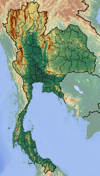
English: Location map of Thailand
Equirectangular projection, N/S stretching 103 %. Geographic limits of the map:
|
| Date | |
| Source | Own work (backgroung : http://www.maps-for-free.com) |
| Author | Dr Brains |
གན་རྒྱ་ནང་ཞུགས་པ།
I, the copyright holder of this work, hereby publish it under the following licenses:

|
Permission is granted to copy, distribute and/or modify this document under the terms of the GNU Free Documentation License, Version 1.2 only as published by the Free Software Foundation; with no Invariant Sections, no Front-Cover Texts, and no Back-Cover Texts. A copy of the license is included in the section entitled GNU Free Documentation License. | 1.2 only |
|
|
Permission is granted to copy, distribute and/or modify this document under the terms of the GNU Free Documentation License, Version 1.3 or any later version published by the Free Software Foundation; with no Invariant Sections, no Front-Cover Texts, and no Back-Cover Texts. A copy of the license is included in the section entitled GNU Free Documentation License.
|
If this file is eligible for relicensing, it may also be used under the Creative Commons Attribution-ShareAlike 3.0 license. The relicensing status of this image needs to be manually reviewed by an experienced user. You can help.
|
You may select the license of your choice.
ཡིག་ཆའི་ལོ་རྒྱུས།
ཟླ་ཚེས་/དུས་ཚོད་གནུན་ཏེ་རྩོམ་ཡིག་ལ་ལྟ་བ།
| ཚེས་གྲངས། / དུས་ཚོད། | བསྡུས་དོན། | ཚད། | སྤྱོད་མི། | བསམ་ཚུལ། | |
|---|---|---|---|---|---|
| ད་ལྟ། | ༡༦:༥༥, ༡༢ ཟླ་དྲུག་པ། ༢༠༡༢ | | ༢,༠༠༠ × ༣,༥༡༧ (༡༠.༢༤ MB) | Dr Brains |
ཡིག་ཆ་བེད་སྤྱོད་ཁུལ།
There are no pages that use this file.
Global file usage
The following other wikis use this file:
- Usage on af.wikipedia.org
- Usage on als.wikipedia.org
- Usage on ar.wikipedia.org
- Usage on ast.wikipedia.org
- Usage on ban.wikipedia.org
- Taman Nasional Mu Ko Ang Thong
- Taman Nasional Laem Son
- Taman Nasional Kaeng Krachan
- Taman Nasional Khao Lak–Lam Ru
- Taman Nasional Kui Buri
- Taman Nasional Sai Thong
- Taman Nasional Si Phang Nga
- Kompléks Wana Dong Phayayen–Khao Yai
- Taman Nasional Thale Ban
- Taman Nasional Thong Pha Phum
- Taman Nasional Chaloem Phrakiat Thai Prachan
- Taman Nasional Chaloem Rattanakosin
- Taman Nasional Hat Khanom–Mu Ko Thale Tai
- Taman Nasional Kaeng Krung
- Taman Nasional Khao Laem
- Taman Nasional Khao Lampi–Hat Thai Mueang
- Taman Nasional Khao Phanom Bencha
- Taman Nasional Khlong Phanom
- Taman Nasional Khuean Srinagarindra
- Taman Nasional Lam Nam Nan
- Taman Nasional Mae Wa
- Taman Nasional Namtok Chet Sao Noi
- Taman Nasional Nam Phong
- Ban Chiang
- Taman Lelintihan Ayutthaya
- Kota Malelintihan Sukhothai miwah Kota Malelintihan Kakait
- Usage on ba.wikipedia.org
- Usage on bh.wikipedia.org
- Usage on bn.wikipedia.org
- Usage on bs.wikipedia.org
- Usage on ca.wikipedia.org
- Usage on ceb.wikipedia.org
- Usage on ce.wikipedia.org
- Usage on cs.wikipedia.org
View more global usage of this file.