
File:LocationWesternAfrica.png
No higher resolution available.
LocationWesternAfrica.png (༣༥༩ × ༣༥༩ བརྙན་རྒྱུ།, ཡིག་ཆ་ཆེ་ཆུང།: ༧ KB, རྣམ་གཞག།: image/png)

|
File:Africa-countries-western.svg is a vector version of this file. It should be used in place of this PNG file when not inferior.
File:LocationWesternAfrica.png → File:Africa-countries-western.svg
For more information, see Help:SVG. |
 |
བསྡུས་དོན།
| Description |
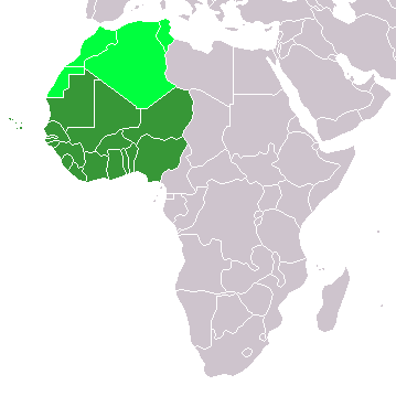
Map: Africa – Western Africa:
|
| Date | ༤ ཟླ་བ་གཉིས་པ། ༢༠༠༦ (original upload date) |
| Source | No machine-readable source provided. Own work assumed (based on copyright claims). |
| Author | No machine-readable author provided. E Pluribus Anthony~commonswiki assumed (based on copyright claims). |
གན་རྒྱ་ནང་ཞུགས་པ།
| I, the copyright holder of this work, release this work into the public domain. This applies worldwide. In some countries this may not be legally possible; if so: I grant anyone the right to use this work for any purpose, without any conditions, unless such conditions are required by law. |
ཡིག་ཆའི་ལོ་རྒྱུས།
ཟླ་ཚེས་/དུས་ཚོད་གནུན་ཏེ་རྩོམ་ཡིག་ལ་ལྟ་བ།
| ཚེས་གྲངས། / དུས་ཚོད། | བསྡུས་དོན། | ཚད། | སྤྱོད་མི། | བསམ་ཚུལ། | |
|---|---|---|---|---|---|
| ད་ལྟ། | ༡༣:༡༧, ༡༡ ཟླ་བཅུ་གཅིག་པ། ༢༠༢༢ | | ༣༥༩ × ༣༥༩ (༧ KB) | ColorfulSmoke | . |
| ༡༡:༥༦, ༡༡ ཟླ་བཅུ་གཅིག་པ། ༢༠༢༢ |  | ༣༦༠ × ༣༥༩ (༧ KB) | ColorfulSmoke | ||
| ༡༦:༤༧, ༡༧ ཟླ་གསུམ། ༢༠༡༨ |  | ༣༦༠ × ༣༩༢ (༡༠ KB) | Maphobbyist | Upload | |
| ༢༠:༥༤, ༣༡ ཟླ་གསུམ། ༢༠༡༦ |  | ༣༦༠ × ༣༩༢ (༡༣ KB) | Fry1989 | Reverted to version as of 21:24, 9 July 2011 (UTC) | |
| ༢༣:༢༤, ༡༥ ཟླ་གསུམ། ༢༠༡༦ |  | ༣༦༠ × ༣༩༢ (༡༠ KB) | Hpyounes | new colors | |
| ༢༡:༢༤, ༩ ཟླ་བདུན་པ། ༢༠༡༡ |  | ༣༦༠ × ༣༩༢ (༡༣ KB) | Maphobbyist | South Sudan has become independent on July 9, 2011. Sudan and South Sudan are shown with the new international border between them. | |
| ༠༨:༠༩, ༡༡ ཟླ་བཅུ་གཉིས་པ། ༢༠༠༧ |  | ༣༦༠ × ༣༩༢ (༡༤ KB) | Hoshie | added Cabinda (Angola) and Montenegro. | |
| ༡༠:༥༥, ༥ ཟླ་གཉིས་པ། ༢༠༠༦ |  | ༣༦༠ × ༣༩༢ (༨ KB) | E Pluribus Anthony~commonswiki | Map: Western Africa, including Maghreb (location) | |
| ༡༩:༥༢, ༤ ཟླ་གཉིས་པ། ༢༠༠༦ |  | ༣༦༠ × ༣༩༢ (༩ KB) | E Pluribus Anthony~commonswiki | Map: Western Africa, including Maghreb (location) |
ཡིག་ཆ་བེད་སྤྱོད་ཁུལ།
There are no pages that use this file.
Global file usage
The following other wikis use this file:
- Usage on ab.wikipedia.org
- Usage on ace.wikipedia.org
- Usage on af.wikipedia.org
- Usage on als.wikipedia.org
- Usage on am.wikipedia.org
- Usage on ar.wikipedia.org
- ليبيا
- جيبوتي
- موريتانيا
- تونس
- السودان
- الصحراء الغربية
- أنغولا
- أوغندا
- إسبانيا
- تشاد
- النيجر
- مالي
- السنغال
- غامبيا
- غينيا بيساو
- غينيا
- سيراليون
- ليبيريا
- غانا
- توغو
- بنين
- بوركينا فاسو
- الصومال
- كينيا
- تنزانيا
- الغابون
- زامبيا
- موزمبيق
- زيمبابوي
- البرتغال
- الكاميرون
- جمهورية الكونغو الديمقراطية
- بوتسوانا
- جنوب إفريقيا
- جمهورية إفريقيا الوسطى
- جمهورية الكونغو
- سيشل
- ناميبيا
View more global usage of this file.