
File:China 100.78713E 35.63718N.jpg

Size of this preview: ༨༠༠ × ༥༩༩ pixels. Other resolutions: ༣༢༠ × ༢༤༠ pixels | ༦༤༠ × ༤༧༩ pixels | ༡,༠༢༤ × ༧༦༦ pixels | ༡,༢༨༠ × ༩༥༨ pixels.
ཐོག་མའི་ཡིག་ཆ། (༡,༢༨༠ × ༩༥༨ བརྙན་རྒྱུ།, ཡིག་ཆ་ཆེ་ཆུང།: ༢༢༦ KB, རྣམ་གཞག།: image/jpeg)
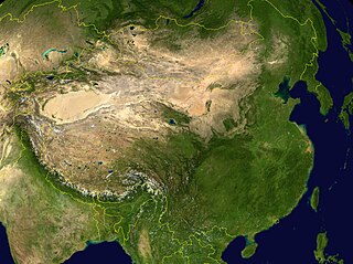
NASA World Wind screenshot.
| This image is in the public domain because it is a screenshot from NASA’s globe software World Wind using a public domain layer, such as Blue Marble, MODIS, Landsat, SRTM, USGS or GLOBE.
|
 |
derivative works
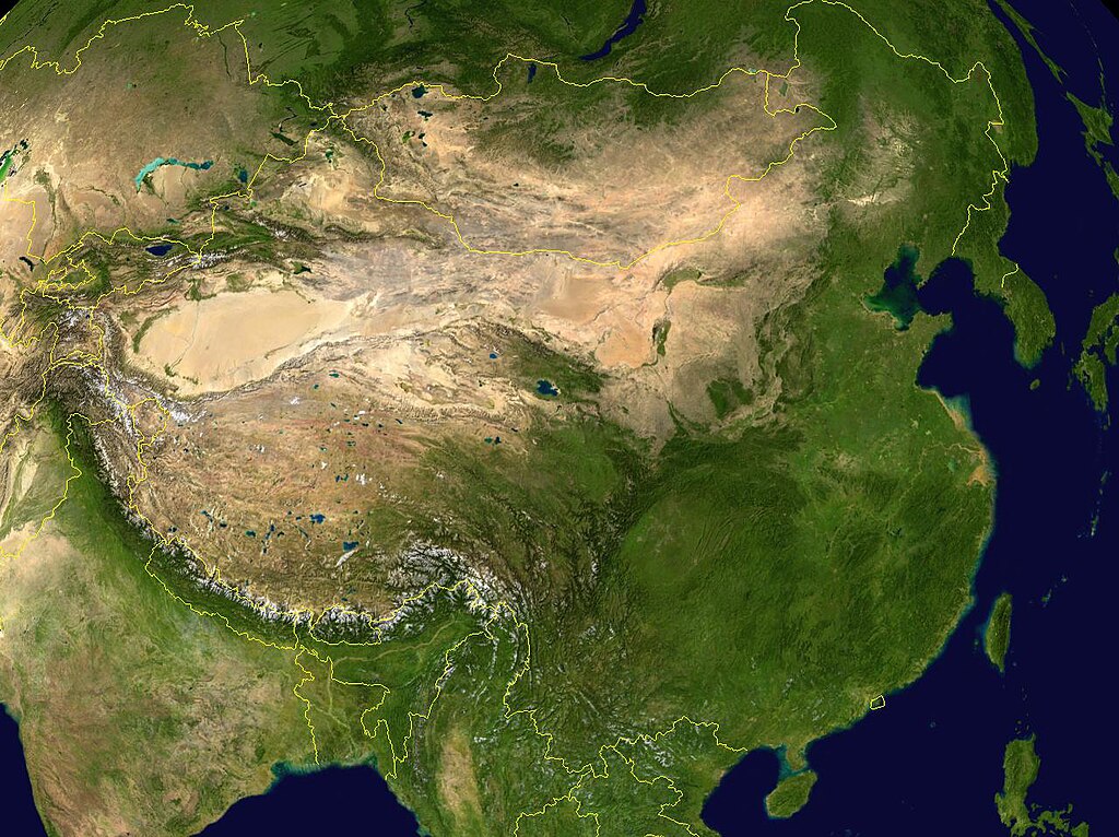
Derivative works of this file: China 100.78713E 35.63718N-2010-23-08.jpg
.
ཡིག་ཆའི་ལོ་རྒྱུས།
ཟླ་ཚེས་/དུས་ཚོད་གནུན་ཏེ་རྩོམ་ཡིག་ལ་ལྟ་བ།
| ཚེས་གྲངས། / དུས་ཚོད། | བསྡུས་དོན། | ཚད། | སྤྱོད་མི། | བསམ་ཚུལ། | |
|---|---|---|---|---|---|
| ད་ལྟ། | ༡༡:༢༨, ༡༥ ཟླ་ལྔ་བ། ༢༠༠༥ | | ༡,༢༨༠ × ༩༥༨ (༢༢༦ KB) | Rex | NASA World Wind screenshot. {{PD-USGov-NASA}} Category:Maps of China |
ཡིག་ཆ་བེད་སྤྱོད་ཁུལ།
pagelinks འདི་ལ་སྦྲེལ་ཡོད།
Global file usage
The following other wikis use this file:
- Usage on af.wikipedia.org
- Usage on ang.wikipedia.org
- Usage on an.wikipedia.org
- Usage on ar.wikipedia.org
- Usage on az.wikipedia.org
- Usage on bm.wikipedia.org
- Usage on bn.wikipedia.org
- Usage on bxr.wikipedia.org
- Usage on ca.wikipedia.org
- Usage on ca.wikibooks.org
- Usage on cs.wikipedia.org
- Usage on da.wikipedia.org
- Usage on dz.wikipedia.org
- Usage on el.wikipedia.org
- Usage on en.wikipedia.org
- Usage on eo.wikipedia.org
- Usage on es.wikipedia.org
- Usage on fa.wikipedia.org
- Usage on fo.wikipedia.org
- Usage on fr.wikipedia.org
- Usage on gcr.wikipedia.org
- Usage on gl.wikipedia.org
- Usage on hi.wikipedia.org
- Usage on hr.wikipedia.org
- Usage on hu.wikipedia.org
- Usage on hy.wikipedia.org
- Usage on hyw.wikipedia.org
- Usage on id.wikipedia.org
- Usage on ig.wikipedia.org
- Usage on incubator.wikimedia.org
- Usage on io.wikipedia.org
- Usage on it.wikipedia.org
View more global usage of this file.