
File:LocationSaoTomeAndPrincipe.png
No higher resolution available.
LocationSaoTomeAndPrincipe.png (༢༥༠ × ༡༡༥ བརྙན་རྒྱུ།, ཡིག་ཆ་ཆེ་ཆུང།: ༧ KB, རྣམ་གཞག།: image/png)
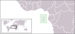
Location map for the São Tomé and Príncipe.
Originally created for English Wikipedia by Vardion.
| This work has been released into the public domain by its author, Vardion. This applies worldwide. In some countries this may not be legally possible; if so: |
ཡིག་ཆའི་ལོ་རྒྱུས།
ཟླ་ཚེས་/དུས་ཚོད་གནུན་ཏེ་རྩོམ་ཡིག་ལ་ལྟ་བ།
| ཚེས་གྲངས། / དུས་ཚོད། | བསྡུས་དོན། | ཚད། | སྤྱོད་མི། | བསམ་ཚུལ། | |
|---|---|---|---|---|---|
| ད་ལྟ། | ༢༢:༣༤, ༣༠ ཟླ་བརྒྱད་པ། ༢༠༡༡ | | ༢༥༠ × ༡༡༥ (༧ KB) | Hoshie | added South Sudan |
| ༢༢:༥༤, ༡༢ ཟླ་བཅུ་གཉིས་པ། ༢༠༠༤ |  | ༢༥༠ × ༡༡༥ (༦ KB) | EugeneZelenko | Location map for the São Tomé and Príncipe.<br/>Originally created for English Wikipedia by Vardion.<br/>{{PD}}<br/>Category:Country locator maps |
ཡིག་ཆ་བེད་སྤྱོད་ཁུལ།
pagelinks འདི་ལ་སྦྲེལ་ཡོད།
Global file usage
The following other wikis use this file:
- Usage on als.wikipedia.org
- Usage on am.wikipedia.org
- Usage on ar.wikipedia.org
- Usage on azb.wikipedia.org
- Usage on ban.wikipedia.org
- Usage on be-tarask.wikipedia.org
- Usage on be.wikipedia.org
- Usage on bg.wikipedia.org
- Usage on bjn.wikipedia.org
- Usage on br.wikipedia.org
- Usage on bs.wikipedia.org
- Usage on ca.wikipedia.org
- Usage on ckb.wikipedia.org
- Usage on de.wikipedia.org
- Usage on de.wikinews.org
- Usage on de.wikivoyage.org
- Usage on de.wiktionary.org
- Usage on dsb.wikipedia.org
- Usage on en.wikipedia.org
- User:DanielZM/test
- User:Chris huh/List of African countries
- Portal:Africa/Countries/Selected country
- Portal:Africa/Countries/Selected country/40
- Outline of São Tomé and Príncipe
- List of São Tomé and Príncipe–related topics
- United Nations Security Council Resolution 373
- Portal:São Tomé and Príncipe/Intro
- List of moths of São Tomé and Príncipe
- List of butterflies of São Tomé and Príncipe
- Usage on en.wikinews.org
- Usage on en.wikivoyage.org
- Usage on en.wiktionary.org
- Usage on eo.wikipedia.org
- Usage on es.wikipedia.org
- Usage on es.wikinews.org
- Usage on ext.wikipedia.org
- Usage on fa.wikipedia.org
- Usage on fa.wikivoyage.org
- Usage on fiu-vro.wikipedia.org
- Usage on fo.wikipedia.org
- Usage on frp.wikipedia.org
- Usage on fr.wikipedia.org
- Usage on fr.wiktionary.org
View more global usage of this file.