
File:Trópico de Capricórnio.JPG
No higher resolution available.
Trópico_de_Capricórnio.JPG (༦༤༠ × ༤༨༠ བརྙན་རྒྱུ།, ཡིག་ཆ་ཆེ་ཆུང།: ༡༥༠ KB, རྣམ་གཞག།: image/jpeg)
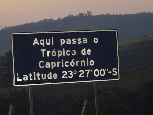
| Description | Trópico de Capricórnio. Linha imaginária que passa pelo Estado de São Paulo. Esta foto mostra o ponto de passagem no município de Santana de Parnaíba. WARNING: This was true for 1917; the Tropic is presently (Epoch 2011) at 23º 26' 16" - See Useful constants | ||
| Date | |||
| Source | Own work | ||
| Author | (HTPF) | ||
| Permission (Reusing this file) |
|
ཡིག་ཆའི་ལོ་རྒྱུས།
ཟླ་ཚེས་/དུས་ཚོད་གནུན་ཏེ་རྩོམ་ཡིག་ལ་ལྟ་བ།
| ཚེས་གྲངས། / དུས་ཚོད། | བསྡུས་དོན། | ཚད། | སྤྱོད་མི། | བསམ་ཚུལ། | |
|---|---|---|---|---|---|
| ད་ལྟ། | ༢༣:༠༢, ༢༨ ཟླ་ལྔ་བ། ༢༠༠༧ | | ༦༤༠ × ༤༨༠ (༡༥༠ KB) | HTPF | {{Information |Description=Trópico de Capricórnio. Linha imaginária que passa pelo Estado de São Paulo. Esta foto mostra o ponto de passagem no município de Santana de Parnaíba. |Source="own work" |Date= "2007-05-28" |Author= Hermógenes Teixeira Pi |
| ༢༣:༠༡, ༢༨ ཟླ་ལྔ་བ། ༢༠༠༧ |  | ༦༤༠ × ༤༨༠ (༡༥༠ KB) | HTPF | {{Information |Description=Trópico de Capricórnio. Linha imaginária que passa pelo Estado de São Paulo. Esta foto mostra o ponto de passagem no município de Santana de Parnaíba. |Source="own work" |Date= "2007-05-28" |Author= Hermógenes Teixeira Pi |
ཡིག་ཆ་བེད་སྤྱོད་ཁུལ།
pagelinks འདི་ལ་སྦྲེལ་ཡོད།
Global file usage
The following other wikis use this file:
- Usage on ar.wikipedia.org
- Usage on arz.wikipedia.org
- Usage on ba.wikipedia.org
- Usage on bn.wikipedia.org
- Usage on ckb.wikipedia.org
- Usage on el.wikipedia.org
- Usage on et.wikipedia.org
- Usage on fa.wikipedia.org
- Usage on it.wikipedia.org
- Usage on pnb.wikipedia.org
- Usage on ru.wikipedia.org
- Usage on sv.wikipedia.org
- Usage on uk.wikipedia.org
- Usage on ur.wikipedia.org